CROSSING OF GENNARGENTU
BOOK NOWCrossing of Gennargentu
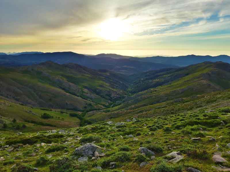
The National Park of Gennargentu, located in the centre of Sardinia, embraces a vast uncontaminated and wild area including the highest peaks of the island. Our trekking of the Gennargentu mountains is a 3 days long tour that crosses the massif south to north. The itinerary will take us walking over the summit of the highest mountains in Sardinia, over 1800 meters above sea level.
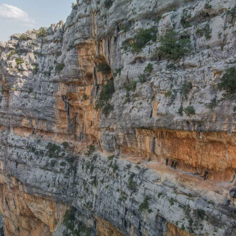
From the streams and rivers at the bottom of the valleys, and through the Durmast and Holly oaks forests that cover the slopes of Gennargentu, our path climbs up to the bare ridges from where we will witness grandiose views over the entire park and over.
We will set off from the little town of Aritzo, following the ancient mule tracks towards the crests that run atop the massif. The path leads straight to the primitive heart of the Barbagia region. The name comes from the Romans' time when these mountains were inhabited by untamed and hostile warriors. Infinite ordeals left us with a memory bank of a thousand legends about the brave Sardinians who settled on these remote mountains.
The dense forests that once covered these mountains had an enormous value and were the primary resource for the ancient Sardinians, as well as they were for all local people until the massive deforestation that occurred during 1800.
We will encounter many unattended huts, some of which we will occupy to spend the night in. Many of these huts were recently rebuilt to host wandering hikers and nature lovers. The panoramas become gradually more sumptuous as we follow our path to the highest peaks until we will reach the second-day summit of Punta La Marmora (1834m) and the crest of Bruncu Spina (1829m).
hide
FIRST DAY
Walking time: 7 h
Length: 12 km
Vertical gain +: 1000 m
SECOND DAY
The second day of the Great Trail is for sure the most remarkable one and the one that will endure the most on anyone’s memory. Starting from a remote area we will hike to a crest from where we will fill our lungs with the purest air and our eyes with the most stunning views. A really steep slope will finally take us to the summit of Punta Lamarmora (1834 metres above sea level), where we can have a long break while enjoying the 360° panoramas. Not far from Punta La Marmora is the long crest of Bruncu Spina, which we will pass to get to the unattended hut where we will spend the night.It is also possible to book a B&B that is very near and enjoy a good sleep and a hot shower too.
Time: 8 h
Lenght: 17,5 km
Vertical gain +: 1100 m
THIRD DAY
Leaving behind the peaks of Punta La Marmora and Bruncu Spina, the trail of Gennargentu carries on north-east, towards the geological boundary that divides the Gennargentu Palaeozoic schist from the Supramonte Mesozoic limestone. Although it may sound a bit techy, the morphology and vegetation of the two areas change drastically. We will walk all day on top of some incredibly panoramic crests, admiring the view over steep slopes and far away horizons.Once we will arrive at the Arcu Correbboi, our team will drive us back to Aritzo (1h 30″ drive)
Time: 5 h
Length: 8,5 km
Vertical gain +: 500 m


Crossing of Gennargentu
€ 360
Meeting location: Aritzo
Meeting time: 9:00
Estimated return to start point: tre giorni dopo, 16:30 circa
Total length: 39 km
Total time: 3 days
Difficulty: medium
hide
What is included?
- Fully qualified local hiking guide
- Third-party and major injuries insurance
- Transfer from ending point back to Aritzo
- Water can be found along the trekking
Should I carry my own food?
The basic package of this tour does not include food and drinks. Each participant must be independent.
This trekking can represent a great lesson in dietary needs to those who are not used to spending more than one day outdoor. Each participant must reduce and optimize one’s own necessities, and in some cases even challenge her/himself
Water can be collected along the trekking. We will pass by many natural springs and rivers. Those who do not trust natural springs should have a portable filter.
What do I need?
- Backpack, at least 50 litres
- Winter sleeping bag
- Inflatable mat
- Tent (Optional)
- Water bottle 2 litres
- Headlight and spare batteries
- Enough food for the whole tour
- Gas burner, gas, stoves, cutlery and plates
- Comfortable clothes
- Boots or hiking shoes with a hard sole
How difficult is the Crossing of Gennargentu?
On the first day of trekking, soon after meeting up in Aritzo, we will walk on uphill paths leading to an unattended hut, where we will spend the night. The following day is the longest and steepest of the three. Anyhow, there is no rush and we can walk calmly, lingering on pauses to admire the beautiful landscape. The third and last day is the easiest but as fascinating as the previous ones. We will reach a secondary road soon after lunchtime, where our team will provide a lift back to Aritzo.